Tushar Mountains Delano Peak Hike
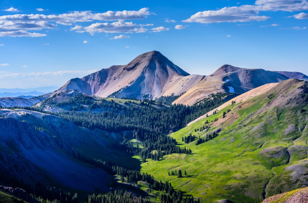
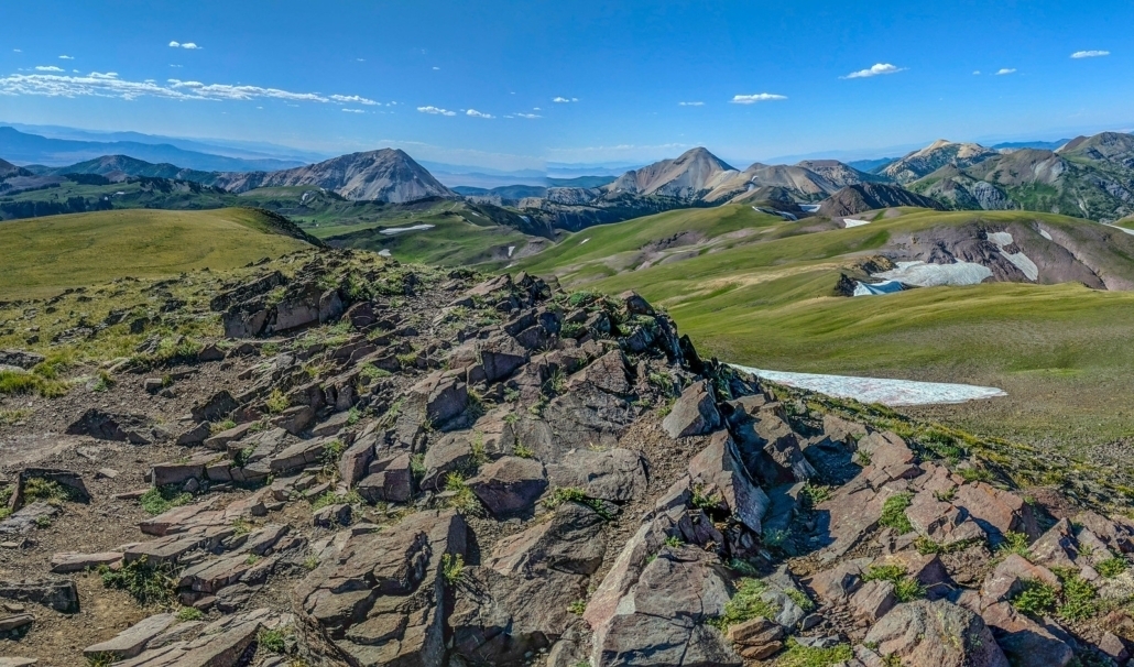
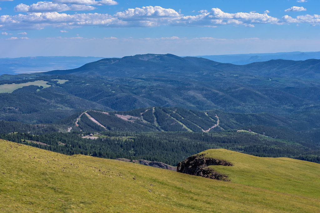
The Tushar Mountains are the third highest mountain range in Utah behind the Uintas in northeast Utah and the La Sals near Moab. With several 12,000 ft peaks above timberline (twelvers), they remind me of the mountain ranges I’ve explored in Colorado.
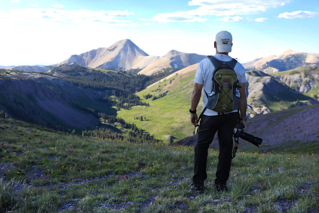
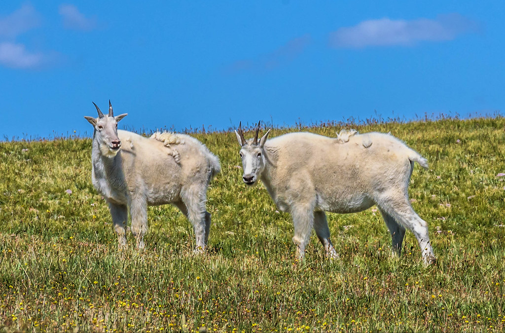
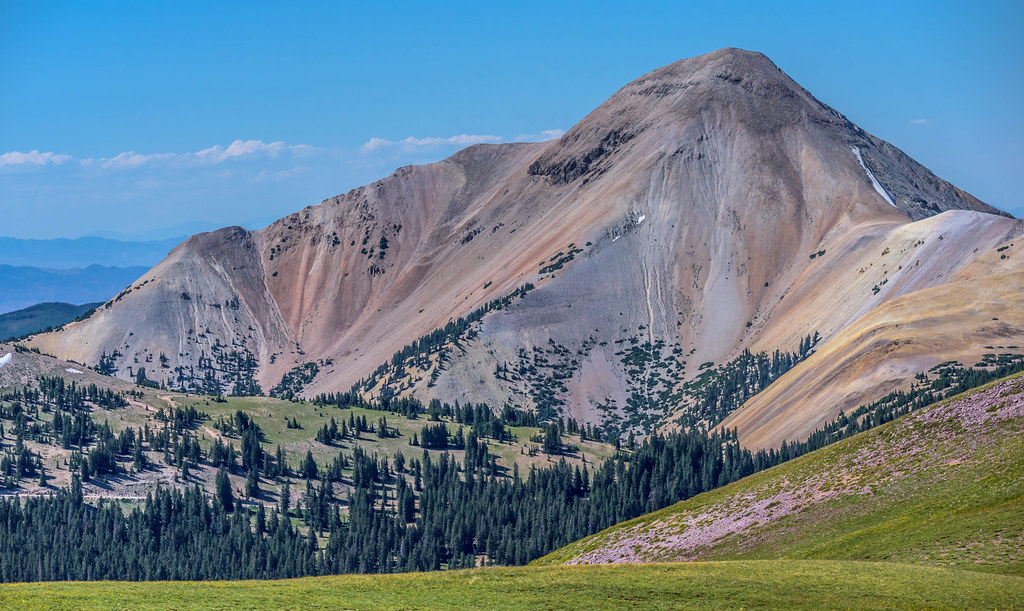
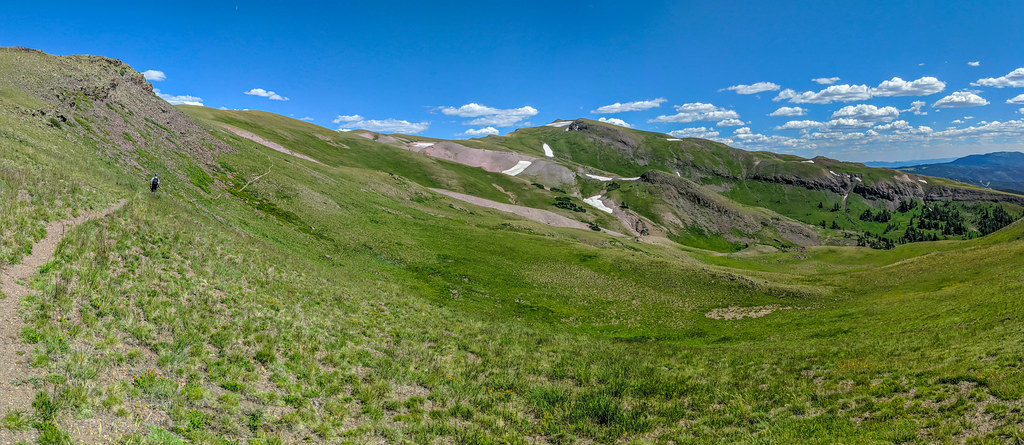
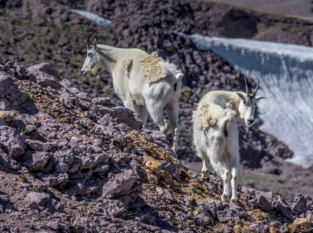
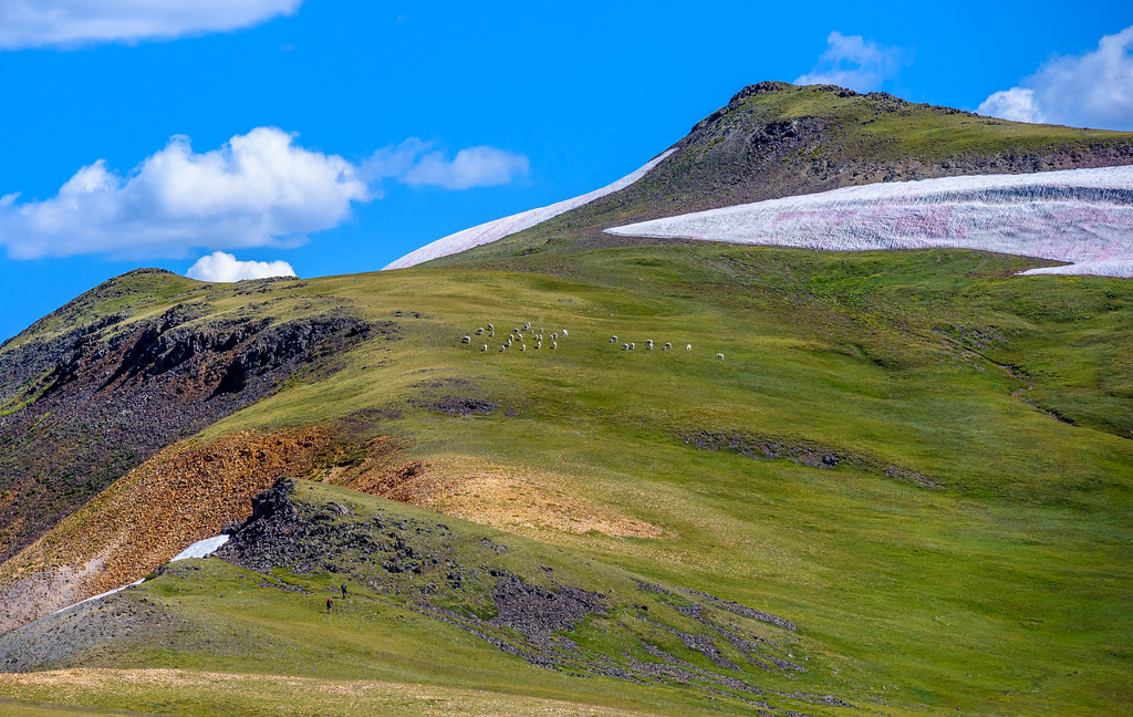
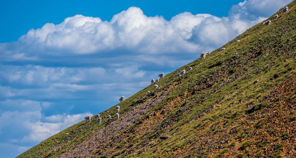
Located in south-central Utah east of the town of Beaver, Delano Peak (12,173 ft) is the highest peak in the Tushars, but the more impressive peaks are Mount Belknap (12,137 ft), the second highest peak, and Mount Baldy (12,090 ft). I hiked to the top of Mt. Belknap several years ago with the plan of coming back to explore Delano Peak. Getting back too much longer than planned but I finally made it with the added incentive of tracking mountain goats that roam in the high alpine meadows among these towering peaks.
After returning from the hike and looking at maps I realized that we took a different route than what we found on the hiking sites we researched. The route we took started much higher up the mountain and was a bit longer in distance. I don’t think it really mattered that much, neither route has any technical climbing just a few steep sections.
Difficulty: Easy to moderate family friendly high elevation hike with some steep sections
Distance & elevation gain: 3 miles out and back with 1,650 feet elevation gain.
Trail type: Singletrack dirt trail (the trail fades in and out along sections of the slopes and meadows)
Dogs: Dog friendly
Fees: None
Seasonality: Spring, Summer, and Fall; Winter snowshoeing may be possible.
Bathroom: There are vault toilets near the Big John Flat campground
* Take water and snacks.
Delano Peak is non-technical peak but the high elevation with a few steep slopes makes it a bit strenuous in some sections. On this particular date in August the late afternoon temperature was 73, which offered a nice escape from the scorching triple digit heat of the St. George area where our day started.
At over 12,000 feet in elevation, Delano Peak offers amazing 360 degree views of the surrounding area. We were able to see Thousand Lakes Mountain, Boulder Mountains, and Henry Mountains near Capitol Reef National Park to the east, Powell Point near Bryce Canyon, Brian Head Peak, Pine Valley Mountains, Wheeler Peak just to name a few well-known landmarks. There is a summit register in a mailbox under a summit sign. Strangely, the sign says 12,169 ft and the nearby geological survey marker says 12,173 ft.
Factoid: Delano Peak was named for Columbus Delano, who severed as as the secretary of the interior under President Grant from November 1, 1870, until resigning on October 19, 1875.
Exit Interstate-15 at Beaver Utah and follow main street to 200 North (Hwy 153) and head east 16 miles to Forest Service Road 123 (Big John Flat). Look for a sign on the right side of 153 directing you to Big John Flat road, which is a dirt road heading slightly uphill to the left. This will lead you to Big John Flat where campgrounds and nearby vault toilets are located.
To get to the spot where we started our hike, which is not where most start, drive 7.6 miles from turning off Hwy 153 (38°22’59.0″N 112°23’48.6″W). This route may not be available past the Poison Creek gate in years when deep patches of snow linger through the summer months in the higher elevation. This was the case just a few days before our trip.
To access the trailhead where most people start, go 5.4 miles from the turn-off to a spot just off Big John Flat Road (FSR 123) where you can park or even camp. (38.36650° N, 112.39555° W).
Due to the deep snowfall the higher elevation of Tushars receives each year, summer and fall would be the best time for making this trip. I suppose it would be possible to snowshoe in the winter, I have friends who have cross-country skied this area extensively.
Mountain goats have thrived in the Tushar Mountains. Originally relocated from the Lone Peak Wilderness Area and Mount Timpanogos on the Wasatch Front and Olympic National Park in Washington state. They were first introduced to this area in 1986 with additional animals brought in 1988. The numbers have grown to the point that the herd was used for relocating animals to other mountain ranges including the La Sal Mountains near Moab and to the Black Hills in South Dakota.
Finding mountain goats was our primary objective this day, and find them we did! I saw the herd from a distance on a previous hike so I had a good idea where they might be, which is right where they were, above Timberline in the meadows and cliff-sides around Delano Peak. We saw two herds this day, in all I would guess there were between 40-50 head in all.
Below is video my hiking buddy @outsidescapes shot the day we were tracking mountain goats on Delano Peak.
Click on images to enlarge
Title | Category | Address | Description | |
---|---|---|---|---|
![]() | Delano Peak | 38.36914893609589,-112.37131992236135 | 12,173 ft | |
![]() | Our route | 38.383056, -112.396833 | There is a turn out here large enough for 2-3 vehicles. | |
![]() | Lower trailhead | 38.367481413302265,-112.3956559070914 | According to most hiking websites, this is the route most people take. We first stopped here but decided to see how high we could start. | |
![]() | Eagle Point Resort | 38.32033808369441,-112.38385613626122 | ||
![]() | Mt Brigham | 38.38613099691802,-112.33798375316661 | 11,709 ft | |
![]() | Mt Baldy | 38.401979068666414,-112.4363275387899 | 12,090 feet | |
![]() | Mount Holly | 38.35286753415677,-112.35774731628811 | 11,985 feet | |
![]() | Mt Belknap | 38.41924251071045,-112.41272368546151 | 12,137 feet |